10 Scenic Middle Fork Hikes Near Seattle That Aren’t Mailbox Peak or Mount Si
The Middle Fork Snoqualmie Valley is full of iconic trails just a 40-minute drive from Seattle. Easy trails, challenging hikes, camping, climbing, ADA-accessible areas, and access to the Alpine Lakes Wilderness welcome both seasoned explorers and newcomers alike. And if you want to skip Mailbox Peak’s crowds, this itinerary guides you to nearby breathtaking trails that you can explore and protect.
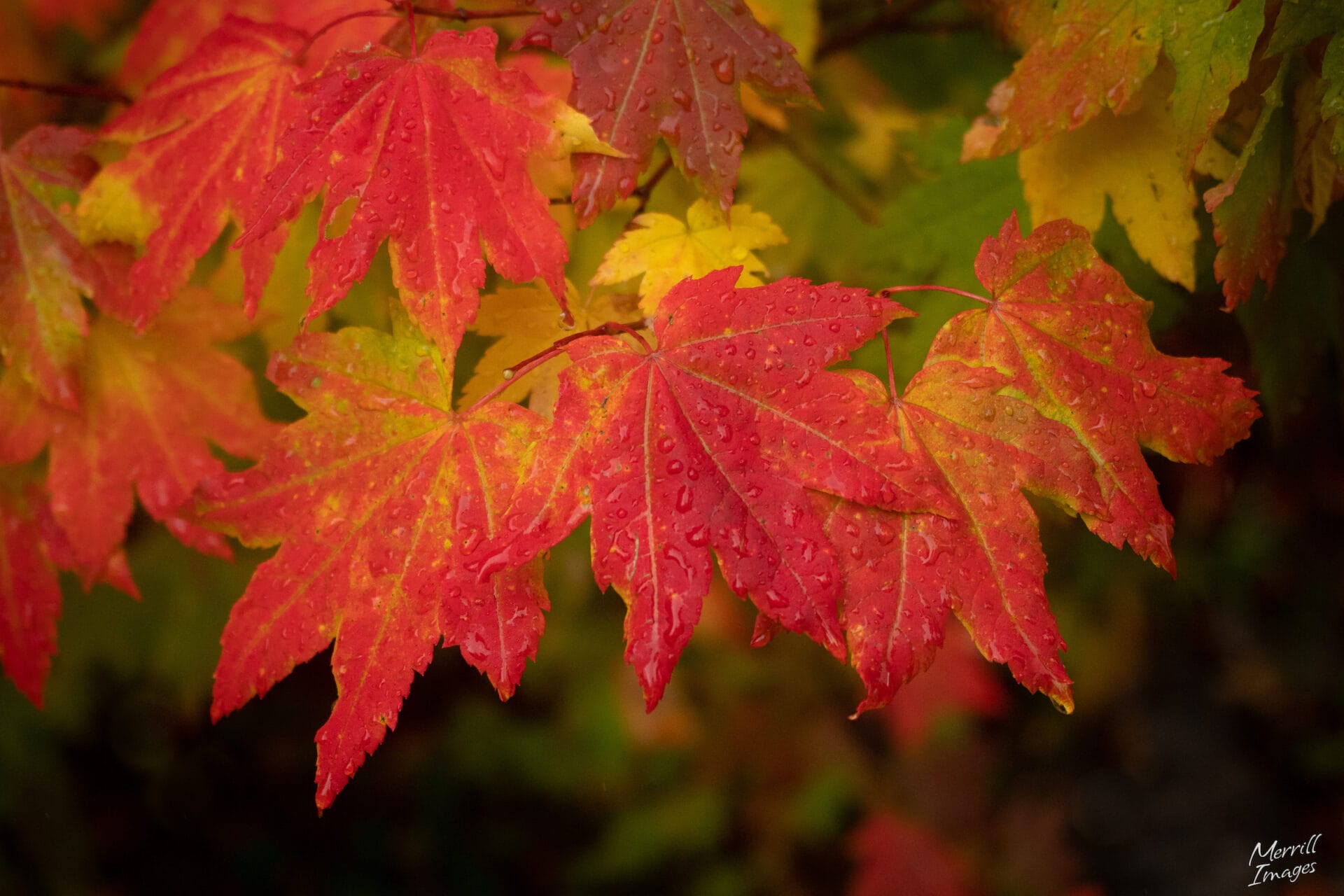
What makes these hikes magical is the rich ecosystem that surrounds them. Shaped by clay deposits formed during the Pleistocene Ice Age, these wildlife-rich forests are draped in moss. They offer scenic trails and picnic areas with access to rivers and lakes that shimmer like emeralds.
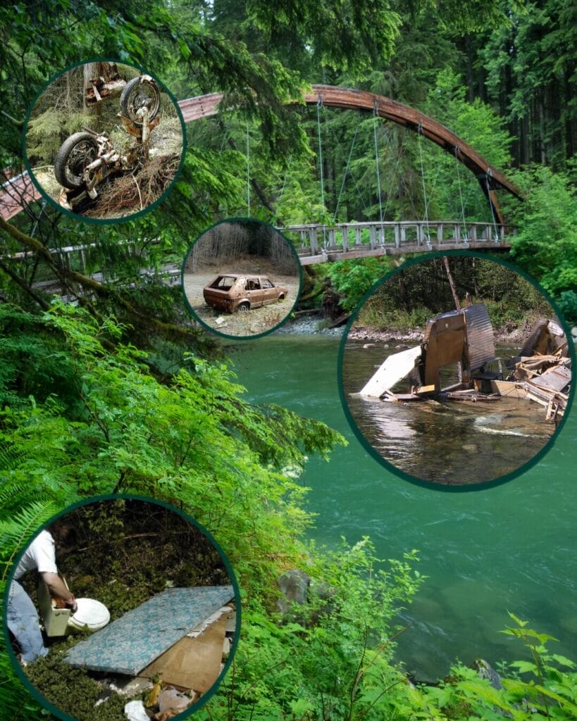
The very qualities that make the Middle Fork so attractive to hikers also make it crucial to protect. Over the past three decades, the Mountains to Sound Greenway Trust and our partners have transformed the Middle Fork from a neglected and overused valley into a model of sustainable access and ecological care. Learn more about the self-sustaining stewardship fund that aims to protect this region forever. And register for a volunteer event to keep these trails in top shape.
Itinerary
-
Boulder Garden Loop Trail
2.5 miles, roundtrip / 800 ft gain
Give some of the busiest trails on Mount Si and Little Si a rest by visiting the stone giants of the lesser-traveled Boulder Garden Loop Trail. Reflect on the beauty of nature while meandering around this 2.5 mile-long loop that features towering, moss-covered granite formations along the forests of Little Si. Thanks to the work of Greenway Trust volunteers in 2025, drainage ditches were built and dug along the trail to divert a stream away from the path. This effort transformed the steeper slopes of this trail into a practical, stable surface for hikers, especially as they approach its scenic viewpoints.Purchase a Discover Pass to access this area.

Boulder Garden Loop -
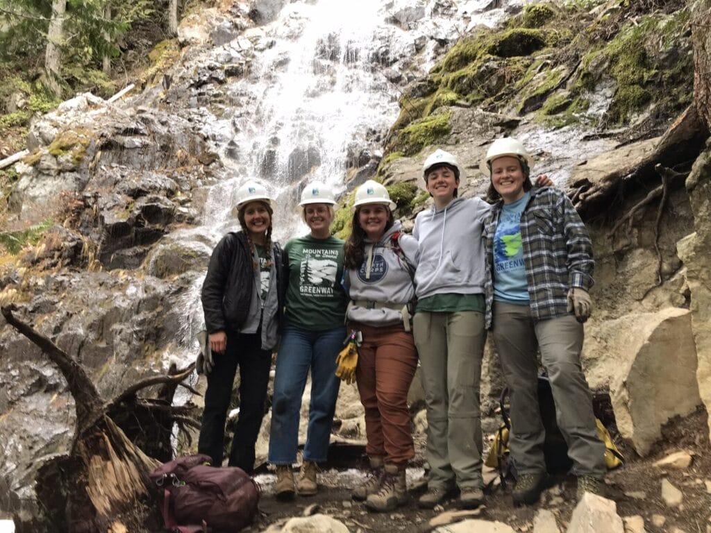
Teneriffe Falls Trail
5.5 miles, roundtrip / 1,585 ft gain
This 5.5-mile trail is a great year-round path that guides hikers to Teneriffe Falls, a cascade nestled within the Mount Si Natural Resources Conservation Area (NRCA). What started out as a logging area has become a protected landscape with sustainable trail access that has been decades in the making. Established in 1987, it was among the first NRCAs in the state, safeguarding a remarkable expanse of 13,735 acres. This protected area encompasses four mountain peaks, including Mount Si, Mount Teneriffe, Green Mountain, and Little Si, each offering unique perspectives of the surrounding landscape. These peaks are adorned with second- and old-growth forests, subalpine meadows, rock outcrops, and delicate wildflowers throughout the spring and summer months. In late 2022, the Greenway Trust partnered with WA-DNR to fly in materials to install a bridge and connector trail between the Teneriffe Falls Trails and the Mount Teneriffe Trail. The new connection provides hikers with a 5-mile loop while clarifying trail locations.Purchase a Discover Pass to access this area.

Greenway Trust Trail Crew in front of Teneriffe Falls -
Dirty Harry's Balcony
4.4 miles, roundtrip / 1,600 ft gain
Dirty Harry’s Balcony Trail is a popular hiking trail with spectacular summer viewpoints overlooking the I-90 corridor. It’s 4.5 miles round-trip and provides access to a growing system of sport climbing routes. The terrain is rocky and hidden within a dense forest. Catch glimpses of Mount Washington and Rattlesnake Ridge as you peek through pockets of clearing on the way to the top.The trail was named after Harry Gault, a local independent logger who gained a reputation for relentless logging near North Bend, Washington. He built roads and logged trees in places thought by other loggers to be too inaccessible to attempt. This reputation eventually led people to give him the nickname of “Dirty Harry.”
For years, this path was difficult to traverse, but in 2017, the Mountains to Sound Greenway Trust partnered with the Washington Trails Association and the Washington State Department of Natural Resources to repair and improve the trail.
Purchase a Discover Pass to access this area.
Learn More >Interstate 90 viewed from Dirty Harry’s Balcony. Photo Credit: Monty Vanderbilt -
Granite Creek Trail to Granite Lake
8.8 miles, roundtrip / 2,270 ft gain
The path to Granite Lakes was once perilous, requiring those who ventured through to cross a creek and bushwack to the beautiful emerald waters at the end of the Granite Creek Trail. This special, lesser-known Granite Creek Trail passes through a lush forest of alder, hemlock, Douglas fir, and cedar. You’ll enjoy the sights and sounds of the roaring Granite Creek. This area got its start as an old logging road, but since 1997, the Mountains to Sound Greenway Trust has worked with partners, including the USDA Forest Service and Washington State Department of Natural Resources to restore the Middle Fork Snoqualmie Valley. This collaborative project improved habitat, reduced erosion, and created year-round recreational access, making Granite Creek Trail a success born from shared effort and care.Purchase a Discover Pass to access this area.
Landscape views of Granite Lake -
Oxbow Loop Trail
1.8 miles, roundtrip / 56 ft gain
The Oxbow Loop Trail offers a scenic, low-intensity walk around Oxbow Lake with plenty of benches to admire it from. For two decades, the Mountains to Sound Greenway Trust and our partners contemplated the emergence of the Oxbow Loop Trail as a special recreation opportunity in the Middle Fork Snoqualmie River Valley. During 2018 and 2019, the trail and trailhead became a reality in a cooperative construction project undertaken by the Greenway Trust in partnership with WA-DNR. It took 12,000 contractor, trail crew, and volunteer hours to create this trail that includes an 80-foot bridge, parking lot, bathroom, and kiosks to provide a great user experience.Purchase a Northwest Forest Pass or Interagency Pass to access this area.
Learn More >Hikers admiring an old growth stump on the Oxbow Loop Trail in the Middle Fork Snoqualmie Valley. Photo Credit: Merrill Images -
Camp Brown
0.45 miles, roundtrip / 0 ft gain
Camp Brown is a scenic, half-mile loop trail that was built following Americans with Disabilities Act (ADA) standards. The wheel-chair accessible picnic areas located along the trail make it an ideal place to appreciate the beautiful views of Mount Garfield and the Wild and Scenic Middle Fork Snoqualmie River. It previously served as a logging camp between 1929 and 1937, a site for a boys’ camp in the 1950s, and later became a USDA Forest Service (USFS) Guard Station. After the station closed in the mid-1970s, this area became neglected, especially as flooding and human use caused major damage to the riparian areas and vegetation. In collaboration with the USFS and other partners, the Mountains to Sound Greenway Trust helped establish the trail and picnic sites at Camp Brown, which opened to the public in 2020. Since then, volunteers have helped to keep this trail and picnic area open despite record rainfall and flooding in the area.Purchase a Northwest Forest Pass or Interagency Pass to access this area.
From behind wheelchair user Camp Brown Trail. Photo Credit: Summer Nowicki -
Pratt Connector to Pratt River Trail
6.0 miles, roundtrip / 100 ft gain
The Pratt Connector trail lies within the Alpine Lakes Wilderness area and follows the Middle Fork of the Snoqualmie River for about three miles. The trail provides a vital connection between the Middle Fork Trailhead with the picturesque Gateway Bridge across the river and the Pratt River Trail, which provides access to several alpine lakes. Prior to this trail’s construction, hikers had to ford the river at Pratt bar in order to access the Pratt Trail.Purchase a Northwest Forest Pass or Interagency Pass to access this area.
Pratt River Trail -
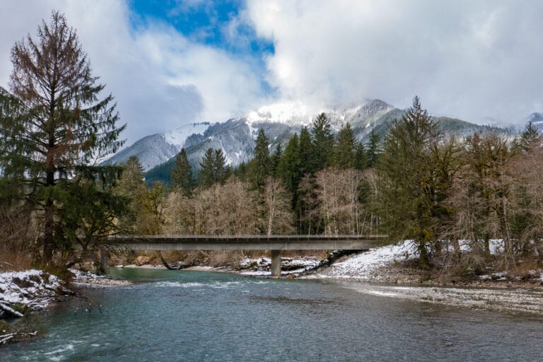
Gateway Bridge to Middle Fork River Trail
12.0 miles, roundtrip / 1,650 feet
Cross the iconic Gateway Bridge to enter a lush river hike covered in thick vegetation to access the 15-mile Middle Fork Trail. The trail serves as a “backbone” of the trail network in the Middle Fork Valley. The bridge is an architectural triumph and stands as a testament to collaboration between volunteers, non-profits, and government agencies. Hikers, backpackers, trail runners, mountain bikers, and equestrians utilize this scenic and tranquil trail, which provides access from the low-elevation reaches of the Valley all the way into the Alpine Lakes Wilderness Area. The trail takes hikers through pockets of old-growth and historic relics from the Valley’s timber and mining eras.Purchase a Northwest Forest Pass or Interagency Pass to access this area.
Gateway Suspension Bridge over the Middle Fork Snoqualmie River. Photo Credit: Merrill Images -
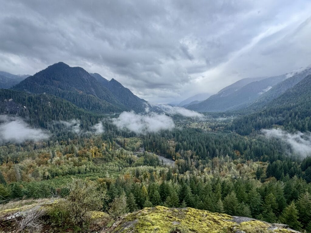
Garfield Ledges Trail
2.2 miles, roundtrip / 830 ft gain
Enjoy sweeping views of the Middle Fork Snoqualmie River year-round on the Garfield Ledges Trail, a 2.2-mile roundtrip climb that offers a perfect cliff-top lunch spot. This path is accessed via the paved Middle Fork Road thanks to a partnership between the Mountains to Sound Greenway Trust and the USDA Forest Service Mt. Baker-Snoqualmie National Forest. The trail showcases lush second-growth forest that is carpeted in moss and historic nurse stumps from logging nearly a century ago. The trail’s creation was a 15-year collaborative effort involving local groups, volunteers, and private donors like REI Co-op and The Boeing Company. Thoughtful planning and construction have made the trail environmentally sustainable and safe, with clear paths and drainage to prevent erosion.Purchase a Northwest Forest Pass or Interagency Pass to access this area.
View from Garfield Ledges Trail -
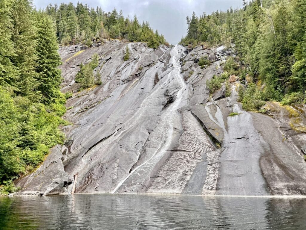
Snoqualmie Lake Trail to Otter Falls
8.5 miles, roundtrip / 1,150 ft gain
This 11-mile roundtrip hike to Otter Falls starts at the Snoqualmie Lake Trailhead, tucked away at the very end of Middle Fork Road. The journey follows the Snoqualmie Lake Trail before branching onto a thoughtfully designed, sustainably built path that leads to a striking granite slab that features a gentle waterfall. Here, the cascade plunges into the serene pond called Lipsy Lake. This spot deep within the Middle Fork Snoqualmie Valley is popular with both day hikers and slab rock climbers who travel four miles up the Snoqualmie Lake Trail to reach the falls. Access was a challenge before the Greenway Trust and partners excavated a new 900-foot trail connection and built timber stairs to the falls. Hikers who use this trail get to enjoy a route that is safer and more sustainable as the trail connection replaces multiple booted in paths, allowing the forest floor to recover.Purchase a Northwest Forest Pass or Interagency Pass to access this area.
Otter Falls Looking for more ways to explore the Mountains to Sound Greenway National Heritage Area? Check out this page for tons of ideas to help you learn about this incredible landscape.