Goopy Gems: The Claylands of the Middle Fork Snoqualmie
In the lower Middle Fork Snoqualmie valley, a large area of clay soils has given rise to a floristically distinctive and wildlife-rich ecosystem. Markedly different from surrounding areas, the “Middle Fork Claylands” have long been an area of special interest due to their flora and fauna that sets them apart not only from their surroundings, but from most other areas in the Cascades. They are one of the most unusual and interesting areas in the Greenway.
The Middle Fork claylands formed during the Pleistocene Ice Age, from about 2.5 million to 13,000 years ago, when the margin of the Puget lobe of the Cordilleran Ice Sheet dammed up the Middle Fork river, forming “periglacial” lakes behind the ice dam, with relatively still waters. This process took place a number of times as the Puget lobe advanced and retreated. These lakes were likely on the scale ofChester Morse Reservoir on the Cedar River to the south, and they occupied the Middle Fork valley upstream from Grouse Ridge and the CCC flats, which are the lateral moraines left by the Puget Lobe. These lakes were filled by meltwater from the Puget Lobe and by the Middle Fork and its tributaries. Those waters carried substantial amounts of suspended fine clay sediments eroded by valley glaciers from higher up in the watershed.
As the water slowed to a nearly motionless state in the glacial lakes, the cloud of tiny clay particles slowly fell out of suspension and settled on the lake bottoms, forming the clay deposits seen today. When the Puget Lobe made its final retreat, the moraine remained until the lake overtopped it, cutting a new channel for the Middle Fork and draining the lake and exposing the claybeds. This channel is occupied today by the Middle Fork, where the Middle Fork road follows the river past the Mine Creek recreation site, through the moraines and upstream to the claylands area.
- The Middle Fork claylands are secondary clay deposits, having been transported by water from their places of origin and concentrated where they are today. In some places it is possible to see distinct depositional layers, called “varves.” The word “clay” itself is a generic term referring to deposits or soils of ultrafine particles. One of the main defining elements of soils is particle size, ranging from large sized sands and gravels to medium sized silts and fine sized clays. The actual particles can be formed from any number of different minerals.
Particle size is an important part of how soils work since it determines how water and air move through the soil, and what will want or not want to grow there. Large sand and gravel particles have large spaces between them, allowing water to drain readily, and air to reach the soil. The fine particles of clays are packed together tightly, leaving little space for air and water. Thus clay soils are usually regarded as wet or heavy, or even “goopy,” since it takes a long time for the water that falls on them to drain away. They hold much more water and nutrients than easily leached lighter soils, but make it hard for air to reach plant roots. In a high rainfall area like the Middle Fork, they never dry out. Plants and trees differ in their tolerances and preferences for heavier versus lighter soils, and forests growing on clay are often quite different from those on better drained silty or sandy ground.
In the Middle Fork valley, the main clayland area extends from not far above Mine Creek up into the lower Pratt valley, covering perhaps five square miles of the valley bottom, on both sides of the river. Some silty and gravelly areas are also mixed in, but most of the lowest elevations in that part of the Middle Fork are composed of clay. The clay is seldom found more than three hundred or so vertical feet in elevation above the river. Both the Pratt and Middle Fork rivers flow directly over claybeds in places, making some unusual swimming holes. In a reversal of what happened in the Ice Age, the river now picks up clay sediment from the old lake bottoms. Although the clay itself appears grayish, it imparts a cloudy, slate green color to the Middle Fork during high water, and an attractive clear greenish tint during low water.
Today the claylands support a forest notably different from surrounding, non-clay areas. The near absence of Douglas fir from the claylands sets them apart from other forests. The most iconic tree of Northwest forests, Douglas fir has been called the finest lumber tree in the world, with light, strong wood, not much inferior to cedar in decay resistance. It much prefers well drained soils, with a distinct aversion to wet feet and clay soils. Western hemlock is somewhat more tolerant of wet ground, but also prefers good drainage and is uncommon on clay.
- Douglas fir and hemlock are the dominant species in almost all lower elevation forests of the western Cascades, including most of the Middle Fork apart from the claylands. They usually outgrow other tree species and create a uniform forest on “good ground.” Since Douglas fir was by far the most valuable and sought after tree during the early days of logging in the Middle Fork, its absence from the claylands caused them to be largely bypassed during the first wave of logging, or only highgraded for cedar. Thus substantial parts of the claylands still support older forests, even approaching near-old growth in places.
The lack of Douglas fir and hemlock on the claylands opens up space for a number of species to flourish that usually get crowded out of other places. Such clay tolerant, high wildlife value trees as hazelnut, pacific crabapple, bitter cherry, and cascara, usually scarce in most Cascade forests, are abundant on the claylands. Sitka spruce is the dominant tree in many places, with large specimens having the massive, muscular limbs found only on really old trees. Thick stands of hazelnut often form the understory below the spruces, a very unusual tree combination. Western red cedar seems to tolerate clay well, and a number of large individuals can be found where they escaped shake rats in the days before cedar roofs went out of fashion. Large, moss draped and picturesque specimens of big leaf maple are the most memorable trees of the claylands, their mossy, wide spreading and fern encrusted limbs giving them great individual character.
Various shrubs, forbs and grasses get a chance to grow on naturally disturbed sites when the clay shifts, toppling trees and letting sunlight reach the ground. In many places enough forage grows to encourage populations of deer and elk high enough to create “elk gardens,” where the continual grazing and browsing from numerous animals keeps down brush and encourages yet further growth of browse species. This is a rare phenomenon in the Cascades, reminiscent of the heavily browsed, open appearance of certain places in the rainforests of Olympic National Park. It is almost impossible not to see wildlife in some of these areas, a sharp contrast to the dark, shady silence of most Douglas fir – hemlock forests. Even parts of the claylands which were heavily logged in recent decades, such as near the Middle Fork road’s concrete bridge, are notable for wildlife.
- The same features that make the claylands unusually rich in both flora and fauna also make them a poor choice for roads, parking areas and even trails. It is difficult and expensive to build and maintain roads and trails on the “bad ground” of the claylands where the earth itself is prone to moving around.
There is, however, very high demand for new recreational opportunities on all public lands near Seattle, including state Department of Natural Resources (DNR,) managed public lands in the Snoqualmie Corridor area (most of the claylands are on DNR lands, along with a small amount on National Forest in the lower Pratt valley.) Fortunately, the Middle Fork valley and nearby areas are large, and most of the acreage is not clay, and quite suitable for new trails and facilities. Thus there is plenty of room for both undisturbed, low use designation in places like the claylands, and higher levels of public use in other areas.
DNR is currently engaging the public and charting the future course for the lands it manages in the Snoqualmie Corridor. The agency is working to strike the right balance between preservation of undisturbed nature, and provision of new outdoor recreational opportunities. The Snoqualmie Corridor planning effort has been ongoing since late 2011, and recommendations will be released in late spring to early summer of 2013. Expectations are for a large number of new trail and facilities recommendations, and for these to be divided into higher and lower priorities, and built as funding allows.
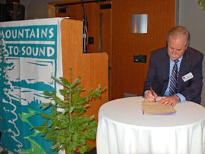
Perhaps the most remarkable thing about the claylands is that they now form the core of what may soon be the largest extent of protected lowlands in the Cascades. At the Greenway Annual Dinner in December 2009, Washington Public Lands commissioner Peter Goldmark signed an order designating the new Middle Fork Snoqualmie Natural Resources Conservation Area (NRCA) and expanding the Mt. Si NRCA. NRCAs are the DNR’s near-equivalent of Wilderness areas for state lands. Together these two areas protect over 25,000 acres, of which about half is low elevation forest.
- Plenty of high mountains have been protected over the years in Washington state, but not very much of the biologically rich lowlands where most of the life is. Commissioner Goldmark’s action in preserving so much low elevation land in a single stroke was truly historic. His designation of these rich lowlands as NRCAs will go down as one of the major achievements in the conservation history of the Cascades, and deserved much more attention than it received at the time. It was a remarkable feat.
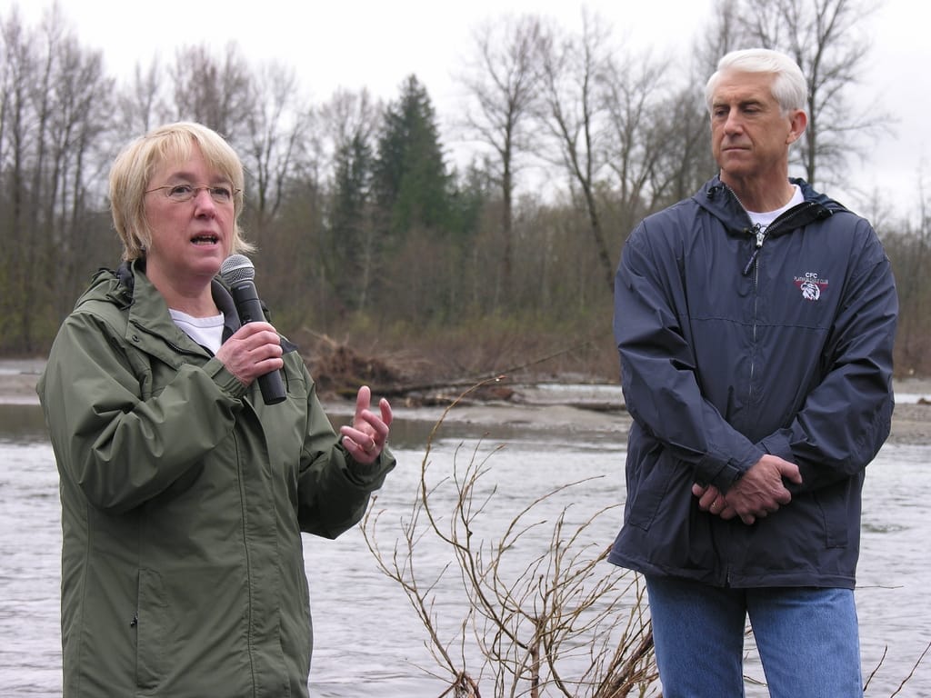
But that’s not the only conservation effort in the claylands and the Middle Fork. Senator Patty Murray, and members of Congress Dave Reichert and Suzan DelBene have introduced legislation to add 22,000 acres to the Alpine Lakes Wilderness. About half of that acreage is low elevation forest in the Middle Fork Snoqualmie valley and its major tributary, the Pratt River valley. It includes the northern end of the claylands where they extend into the lower Pratt valley.
Although the Interstate 90 corridor is normally thought of as the backbone of the Greenway, there is much more than just that. If the Murray/Reichert/DelBene effort is successful, the combination of protected National Forest and state NRCA lands together will mean that the greatest extent of preserved lowland forest in the Cascades won’t be in any of the National Parks or existing Wilderness areas. It will be right here in the heart of the Greenway, in the Middle Fork Snoqualmie, just 45 minutes from downtown. Not all of it is old growth, but much is, and most of what isn’t has been untouched for almost a century, and soon will be. That’s pretty impressive work, and not bad for a modest stretch of clay left over from the Ice Age.