Snoqualmie Valley Trail: Rattlesnake Lake to Snoqualmie
The Snoqualmie Valley Trail offers the opportunity to get out, in any season, and explore one of the most beautiful valleys in the region. The trail parallels the Snoqualmie River and occupies the historic path of a spur line of the Chicago, Milwaukee, St. Paul & Pacific Railroad. At 31 miles in length, the Snoqualmie Valley Trail is the longest regional trail in King County. This itinerary takes you from Rattlesnake Lake to Snoqualmie, a 10-mile one-way bike ride. It also connects you to the historic downtowns and parks along the way to make the most of your day trip.
Itinerary
-
Reinig Bridge
To do a one-way bike ride, you’ll want to park one car in Snoqualmie. Head to Reinig Bridge, just a few minutes from downtown. There’s a little pull off next to the bridge and a set of stairs. If you need to grab anything before you start your journey, you can find what you need in Snoqualmie or North Bend.

-
Cedar Falls Trailhead
Next, drive southeast to the Cedar Falls Trailhead – you’ll need a Discover Pass to park here. Before starting on your journey, take a few minutes to enjoy the beautiful Rattlesnake Lake just across the street. If you want to spend a little more time in the area, visit the Cedar River Watershed Education Center just a few minutes further down the road. The Center’s mesmerizing Rain Drum Court alone justifies the visit.

-
Tanner Landing Park
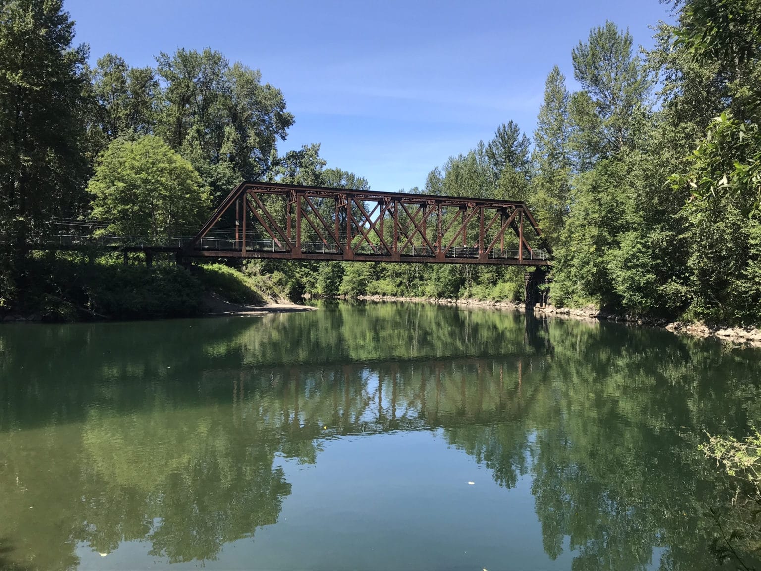
Continuing on the Snoqualmie Valley Trail you’ll soon pass over the South Fork of the Snoqualmie River. This fork of the Snoqualmie has its head waters at Alpental at Snoqualmie Pass. Soon after the river, you’ll go under I-90 and head into North Bend. Just after you cross North Bend Way you’ll arrive at Tanner Landing Park, a King County Natural Area on the banks of the Middle Fork Snoqualmie River. This is a nice place to take a little break and enjoy the view. There’s also a toilet just a short distance from the parking area. Herds of elk are often spotted hanging out here or crossing the river.

-
Historic Downtown North Bend
Continuing north you’ll soon cross the Mt Si road. Just down this road is the Little Si Trailhead, which also has a toilet. Further down this road you’ll find the trailheads for Mount Si, and Mount Teneriffe. Recently the Department of Natural Resources built trails to connect all three peaks.
Continuing on the Snoqualmie Valley Trail for another mile you’ll reach downtown North Bend. Just before that, you’ll arrive at Torguson Park, a large City park that has lots of amenities, including a climbing wall. After Torgusen you’ll reach Ballarat Ave and see a blue wayfinding sign that points to historic downtown North Bend and also shows you the mileage to the neighboring cities. You can follow the sign to downtown North Bend and find something yummy to eat or drink.

-
Tollgate Farm Park
Head back along Ballarat Avenue to the Snoqualmie Valley Trail and turn left to continue to the northwest towards Snoqualmie. In about 0.5 miles, a side trail to the left leads to Tollgate Farm Park. This farm is one of the most important historic sites in the Valley. You can read about its history on page 24 of this City document.

-
Meadowbrook Farm
About 0.6 miles further to the northwest on the Snoqualmie Valley Trail, another side trail to the left leads to another historic farm, Meadowbrook Farm. Meadowbrook once held the title of “largest hop farm in the world”. For a future outing consider our itinerary for this farm: A Walk at Meadowbrook Farm.

-
Meadowbrook Slough
After Meadowbrook, you’ll soon pass through the Mt Si Golf Course and into Three Forks Natural Area, where you’ll ride by Meadowbrook Slough, an important wetland for birds and amphibians. Continue on another couple thousand feet back to the Reinig bridge, and your car.
Have more time? Head into beautiful downtown Snoqualmie for a meal or refreshments, and consider our Historic Walking Tour.
And don’t forget your other car at the Cedar Falls Trailhead!