A Walk at Meadowbrook Farm
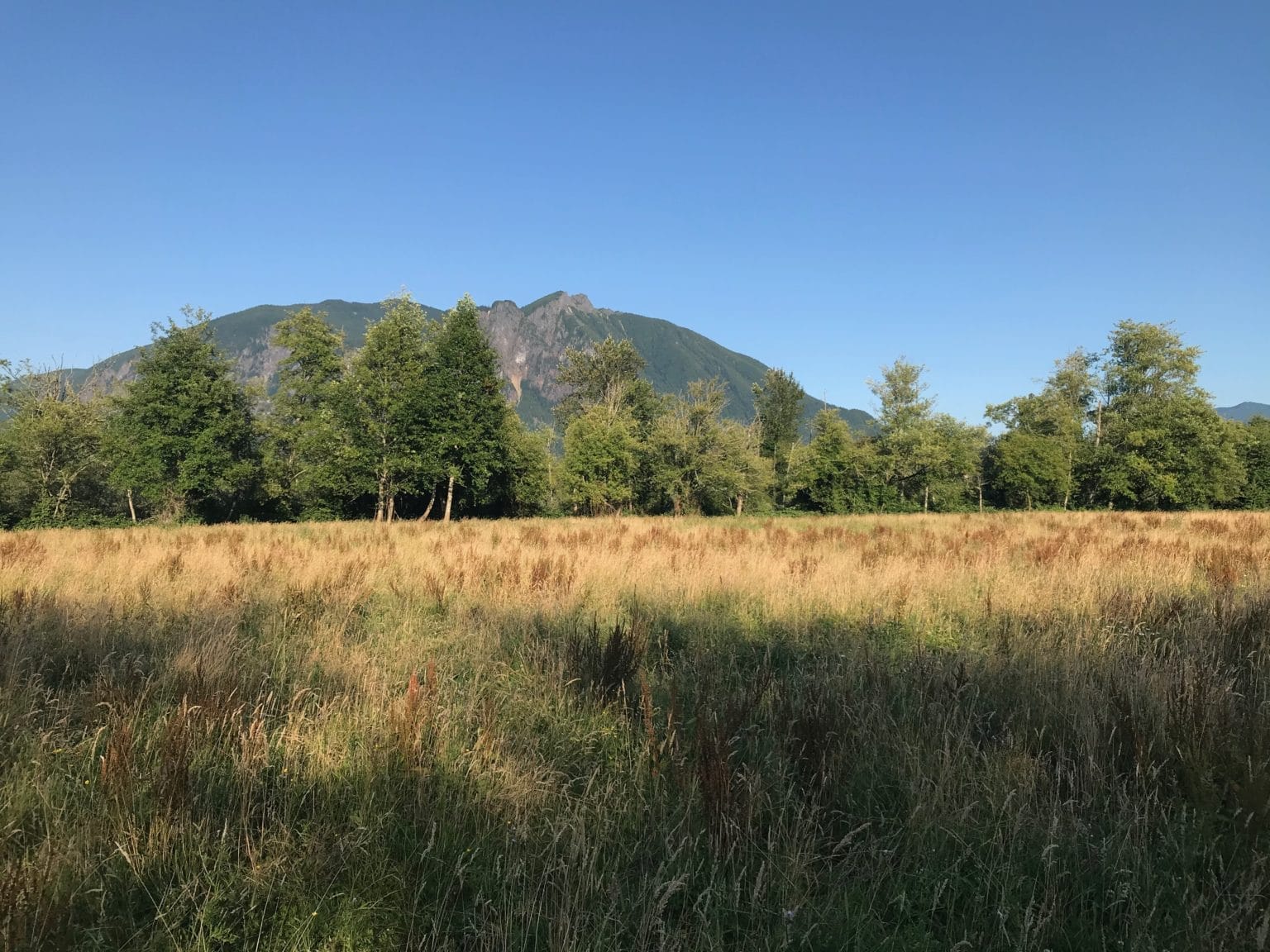
Meadowbrook Farm is an important story location to the Snoqualmie Tribal people. Historically maintained as a prairie through traditional methods, this beautiful 460-acre open space sits on the border of North Bend and Snoqualmie. Sweeping views of Mt Si frame the elk often found munching in its fields. This itinerary leads you through historic spots, art installations, and beautiful scenery. A map available here can help guide you along an approximately 3 mile walking tour.
Itinerary
-
Meadowbrook Farm Interpretive Center
Start your journey at the Interpretive Center at Meadowbrook Farm, a beautiful building that combines elements of the cedar-sided Native American longhouses and sturdy pioneer barns that once stood on this land. Designed by Fall City architect Pat Fels, the Interpretive Center provides a versatile all-weather site for classes, meetings and special events, and houses an exhibit of historic photos from Meadowbrook Farm’s past. The Center contains five cedar-carved houseposts including the “Spirit of Salmon” which represents the importance of salmon and clean water to the Snoqualmie people. Read more about the carved houseposts here.
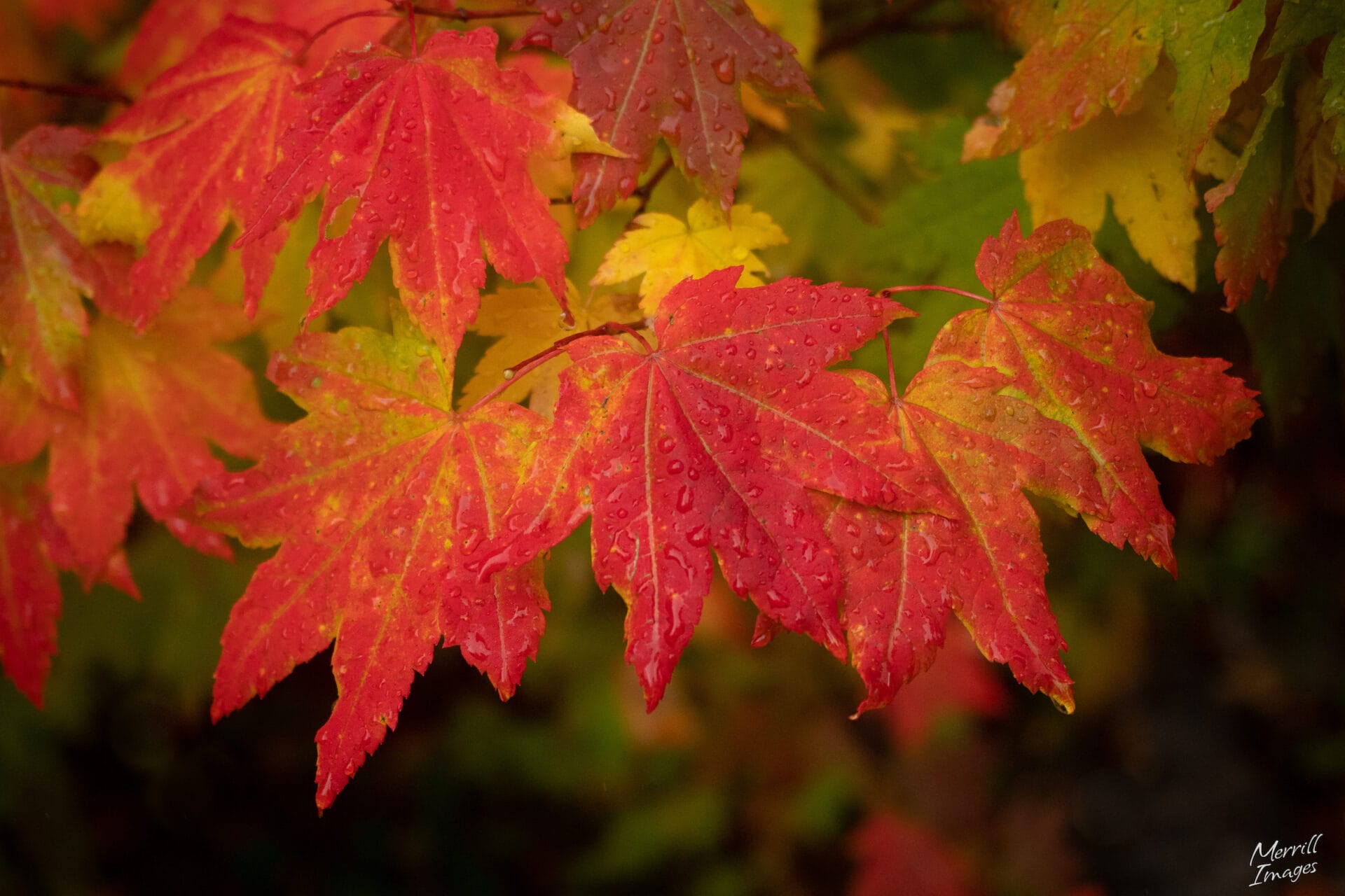
On your way out of the interpretive center notice hops growing up the posts at the entrance. These plants harken back to a time when Meadowbrook held the title of the largest hop farm in the world. In the late 1800’s, the Hop Growers Association owned the property. It included 900 acres with hop kilns for drying, camps and housing for workers, barns, and a three story summer hotel. Read more about the rise and fall of the “hops craze” here.

Hops at Meadowbrook Interpretive Center -
Swing Rock
Next, head northwest on the gravel trail that starts on the driveway circle in front of the Interpretive Center. Pause for a moment when the trail reaches its closest point to the roadway (Highway 203). Across the roadway and a bit beyond (though not visible through the trees) sits a giant boulder.
This boulder – Swing Rock – is part of the Snoqualmie Tribe’s oral history of the Snoqualmie Valley. Their oral traditions say that the giant rock between North Bend and Snoqualmie is the petrified remains of a rope swing that stretched from Mt. Si to Rattlesnake Ridge. Early pioneers named it Quarry Rock and decimated this culturally important landmark through excavation and quarrying for road building. The excavation continued for many years and the scars of this destruction remain visible today.
-
Central Meadow
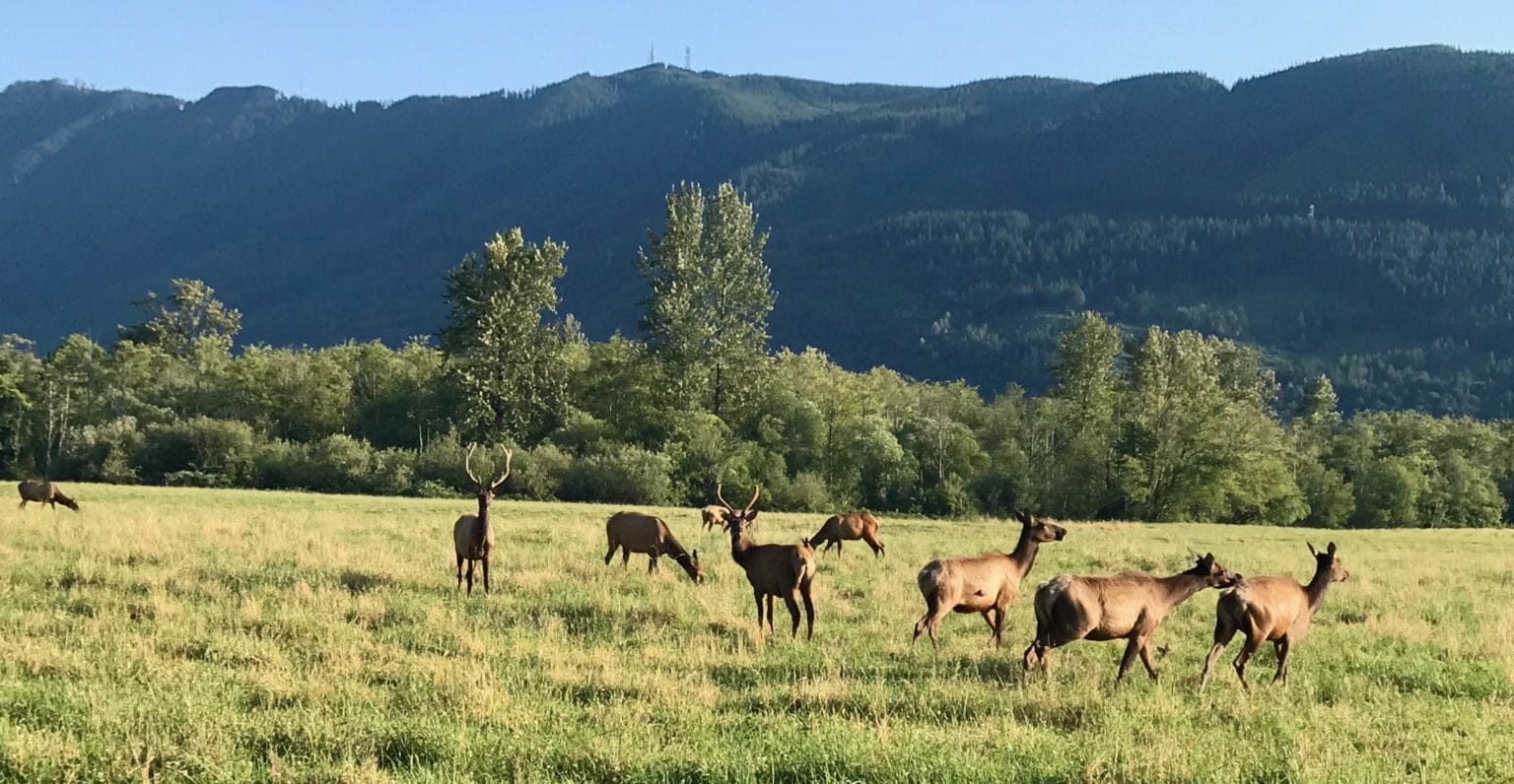
As you continue on the trail the Meadowbrook Farm Central Meadow sits on the right – a popular spot for the local elk herd. The original native elk were essentially eliminated within about 50 years after European settlers arrived in 1858. In 1913 a county game warden, supported by the local Elks Club, arranged to restore the presence of elk by having 44 pregnant female elk shipped in a boxcar from Yellowstone National Park to Snoqualmie. Read more about their story here.
Early morning and twilight are a great time to see the elk. If you come across the herd be sure to observe them from a distance (especially during mating season). Never come in between a mother and her offspring, and leave your pets at home. If you fail to see the elk in person, you can still see evidence of them all around. Look for tracks, scat, antler rubbings on trees, hair on branches or fences, and bugling calls in the fall.

-
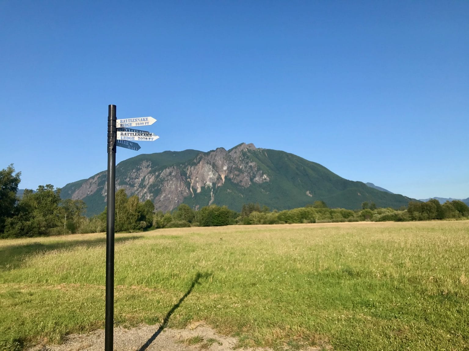
Central Meadow Viewpoint
Continue on the trail as it curves to the right. After a few hundred feet you will arrive at the Central Meadow Viewpoint where a sign with a series of blades indicates the names and elevations of surrounding mountains.
-
Camas Meadow
Next the trail continues through some woods and becomes more primitive. After crossing a foot bridge you will head into the Camas Meadow, named after the beautiful purple Camas lily plant, an important traditional food. The bulbs, which look like onions and taste like pumpkin, are harvested soon after flowering and are usually steamed in pits for 24 hours or more. The cooked bulbs could be served right away, or dried for trade or storage. Historically Camas grew extensively in this meadow, although few remain today.
-
Scout Meadow
Continue on through another wooded section to the Scout Meadow. Then head along the green fence line to an asphalt path. Turn left if you wish to visit the restrooms and/or a playground at Centennial Fields. If not, turn right on the asphalt path to continue.

Play equipment at Centennial Fields Park -
Marie Louie Project
Continue on the trail for some distance to a foot bridge and a series of boardwalks that cut through a beautiful wetland. Be on the look out for birds and wildlife as you enjoy this scenic section.
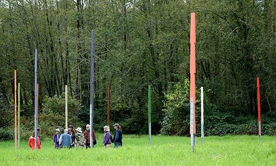
Cross one more footbridge and walk a bit further to the Dike Road Kiosk. At th Kiosk head east (left) and carefully cross Boalch Avenue to pick up another trail. Continue on the trail for a short walk to the Marie Louie Project commemorating an early Snoqualmie medicine woman. A set of ‘articulated’ cedar posts laid out in the meadow mark the direction of sunrise through the calendar cycle.
Instead of the Gregorian calendar we mostly use with its months and numeric days, the Puget Sound Salish calendar terms are keyed to events in nature, like the ripening of berries, and the time to put away paddles at the beginning of winter. The installation features 11 cedar markers, each painted a color corresponding to a seasonal period. The semicircle of cedar posts follows the sunrise as it swings through its 80 plus degree arc at our latitude. Read more about the installation and the life of Marie Louie on the interpretive signs on site or here.

-
Snoqualmie Valley Trail
For anyone wishing to extend their walk, a short trail from the Marie Louie art installation connects to the Snoqualmie Valley Trail. Otherwise, head back towards Boalch Avenue and cross the road. Take a left to return back to the Interpretive Center.