The Mountains to Sound Greenway National Heritage Area (Greenway NHA) is a unique geographic corridor made up of connected ecosystems and communities spanning 1.5 million acres from Seattle to Ellensburg along Interstate 90 in Washington state. Within the Greenway NHA, there are countless nature parks, trails, and spaces for recreation, including a paved regional trail officially named the Mountains to Sound Greenway Trail.
While new connections and trail segments are still being constructed, the continuous trail route, named the Mountains to Sound Greenway Trail, that is currently completed runs from Seattle, across the Interstate 90 floating bridge, through Mercer Island, to the Eastgate neighborhood in Bellevue. Anyone can walk or roll on this trail, exploring the Greenway National Heritage Area right in their backyard.
Future plans will connect the Mountains to Sound Greenway Trail to other existing regional trails, creating a continuous east-west network that serves as a singular connection across the Greenway NHA. The unified trail network will allow for recreation across Washington state and a link to the Great American Rail-Trail, allowing for convenient connections to dozens of other trails across the state and the country.
Keep reading to discover completed sections of the trail, proposed connections, and resources to plan your adventure on the Mountains to Sound Greenway Trail today!

Completed Trail Segments:
Seattle
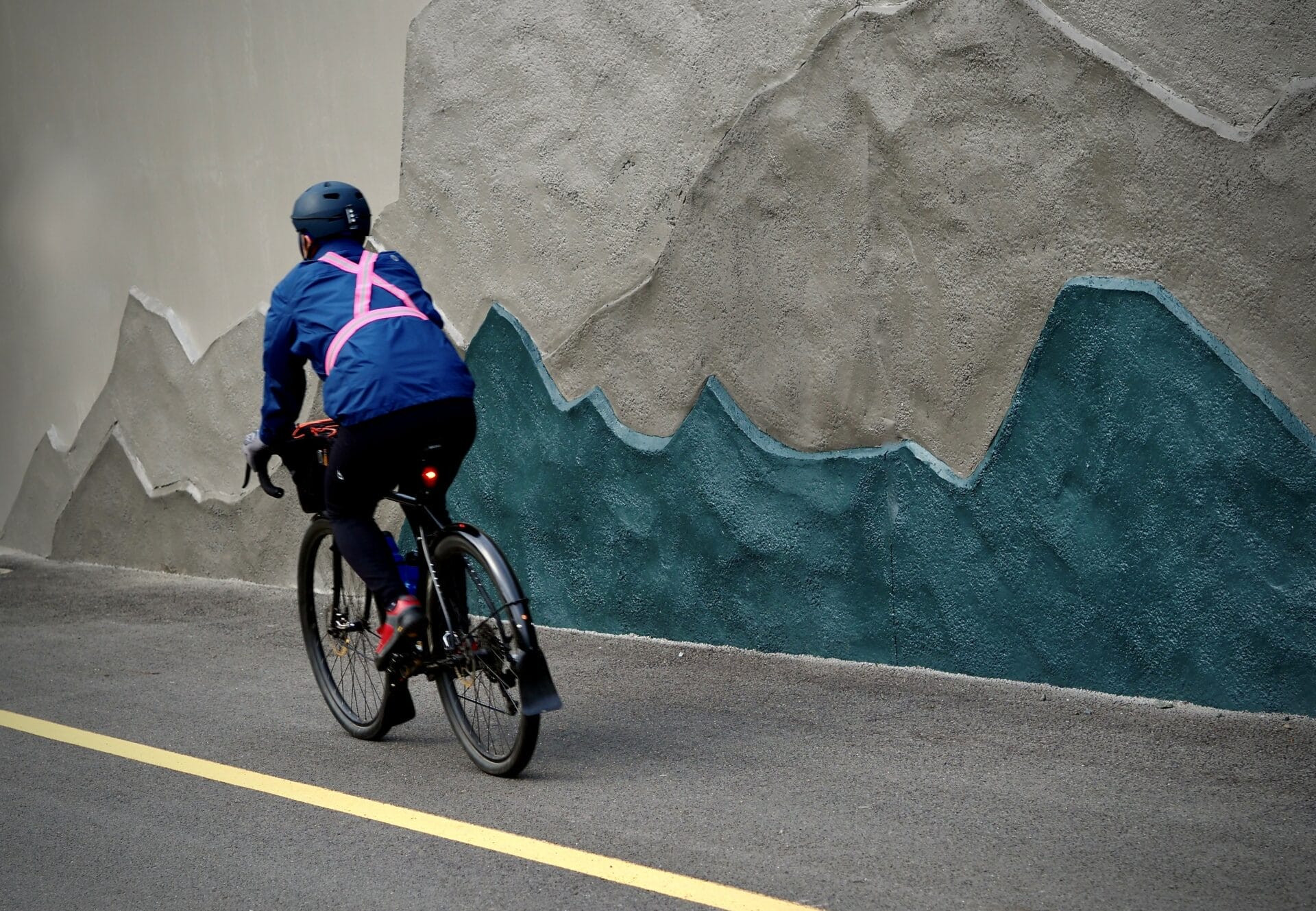
The Mountains to Sound Greenway Trail originates along the waterfront of downtown Seattle. While a challenging gap exists between the downtown portion and Beacon Hill, a significant portion of connected trail begins at Beacon Avenue South, curving around Dr. Jose Rizal Park. The trail extends around the park and runs parallel to I-90, eventually leading through the Mount Baker Tunnel and across the westbound lane of the I-90 floating bridge towards Mercer Island.
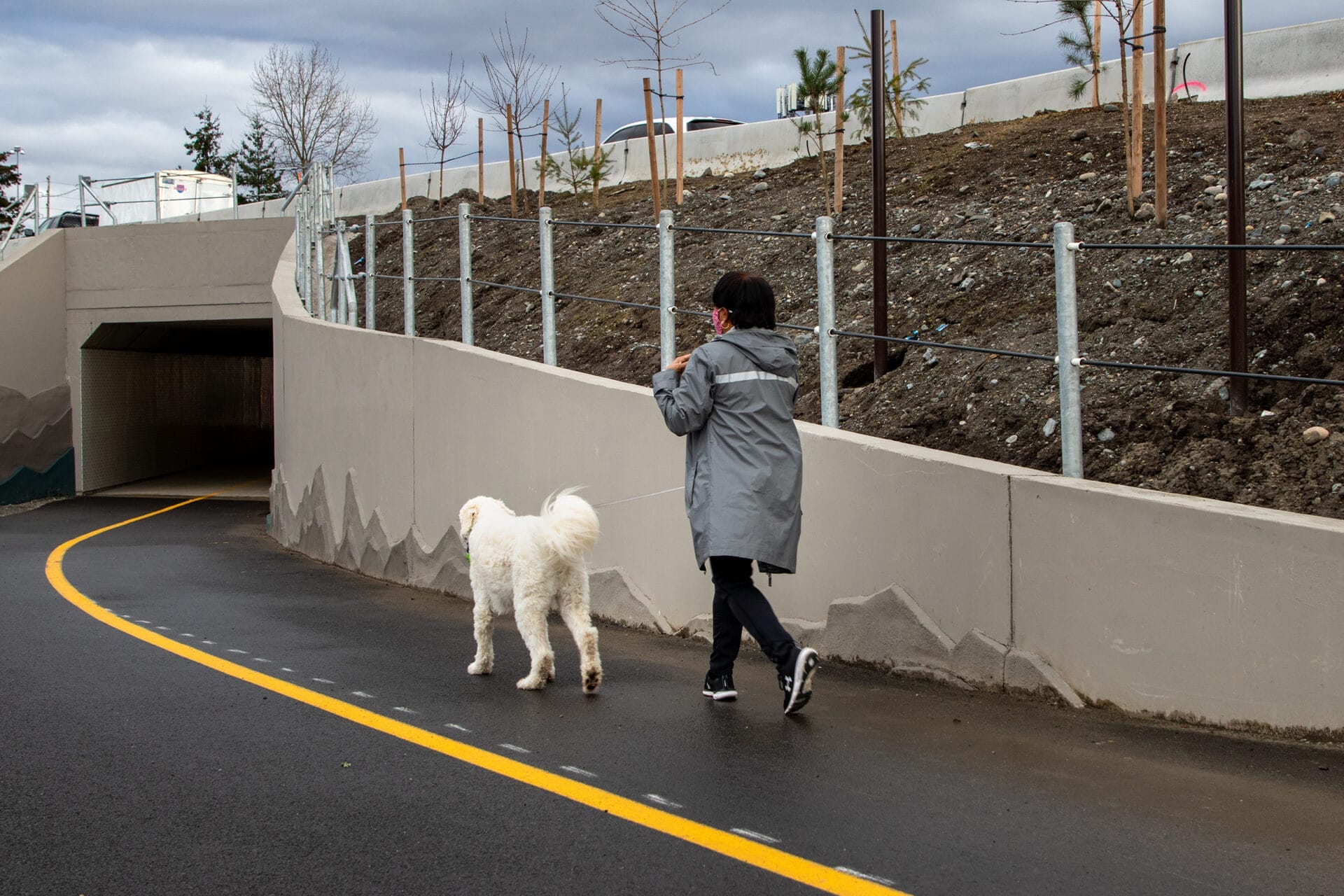
Mercer Island
After extending over the water and into Mercer Island, the Mountains to Sound Greenway Trail leads into the green fields of Aubrey Davis Park. After the park, the trail splits, creating two paths on either side of I-90, and reconnects right before crossing Island Crest Way. It continues leading toward the east side of the island, until it meets the East Channel Bridge and continues over the water in the westbound lane of I-90. The trail runs over the bridge and into Bellevue, right over Enatai Beach park.
Bellevue
After landing in Bellevue, the Mountains to Sound Greenway Trail continues east towards Factoria. It briefly forks, allowing trail goers to split off into the Mercer Slough Nature Park, or to continue east. The trail continues along I-90 and stops next to the bridge over Interstate 90 that leads to the Eastgate Park and Ride, which has plenty of parking and connections to local transit, making it a great starting or stopping point for your next adventure on the trail!
Explore the Mountains to Sound Greenway Trail
Looking to explore the urban Mountains to Sound Greenway Trail for yourself? Check out this itinerary to discover nature parks, educational resources, and other pitstops for a perfect day on the trail. Follow the entire itinerary for a 9-mile adventure, starting in downtown Seattle and ending in Bellevue; or pick your preferred starting and stopping points for a shorter excursion! No matter the length of your trek, you are sure to have a great time exploring the Mountains to Sound Greenway Trail.
The Future of a Cross-Greenway NHA Trail Route
Since the Greenway’s inception, there has been a vision of a continuous east-west network of trails that serves as a singular connection across the Greenway NHA from Puget Sound to Central Washington, allowing the community to walk, bike, or roll across the landscape. While much of the trail is connected today, numerous gaps exist and need to be addressed to bring the vision fully to life. Plans for connections and trail construction are on the horizon, and advocacy and increased funding will be needed to complete the trail.
Current Trail Gaps:
The first steps to completing the trail will be connecting existing sections of the trail where gaps are present. These include connections between Seattle’s waterfront and Beacon Hill, and Factoria and Eastgate. Additionally, there will be a trail that runs through central Issaquah along Newport Way with access to the Issaquah Transit Center.
After crossing through Issaquah, the trail will extend through Preston, utilizing the existing Issaquah to Preston Trail on the north side of I-90, which is managed by King County Parks. It is our hope that this gravel trail section will one day be paved and renamed the Mountains to Sound Greenway Trail. This section is also proposed to be part of the Great American Rail-Trail from coast to coast.
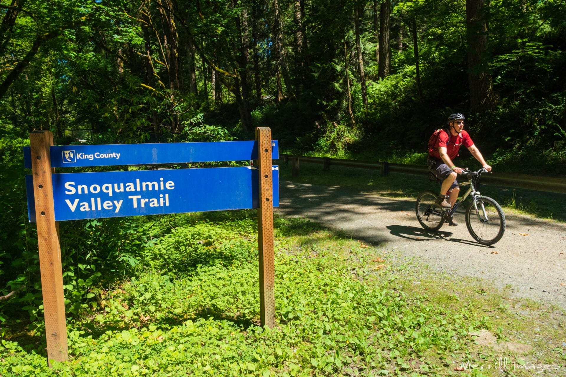
Beyond Preston, the trail route will need to be built through Snoqualmie and join with the existing Snoqualmie Valley Trail. This will allow for a connection to the Palouse to Cascades State Park Trail, completing the vision of an uninterrupted, east-west, regional trail across the Greenway NHA.
Explore this map for a visual of the connections and gaps of the Mountains to Sound Greenway Trail.

Discover Other Trails in the Greenway NHA
The Mountains to Sound Greenway Trail provides a route through the Greenway NHA, leading to parks, educational resources like museums, and other regional trails. For more information on other trails and itineraries for adventures in the Greenway NHA, check out this page!