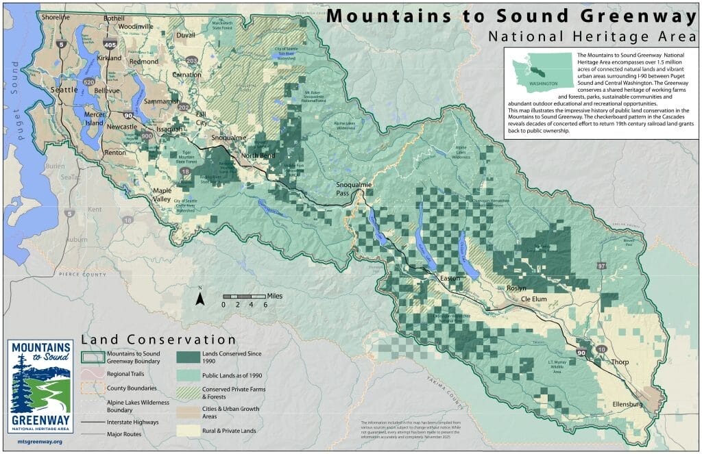
Land Conservation
This map illustrates the impressive history of public land conservation in the Mountains to Sound Greenway. The checkerboard pattern in the Cascades reveals decades of concerted effort to return 19th century railroad land grants back to public ownership.
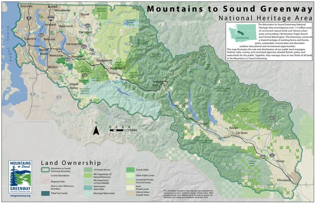
Land Ownership
This map illustrates the role and distribution of our public land managers. Federal, state, and municipal agencies steward forests, parks, and watersheds for the public. Together, they manage close to two thirds of all lands in the Mountains to Sound Greenway.
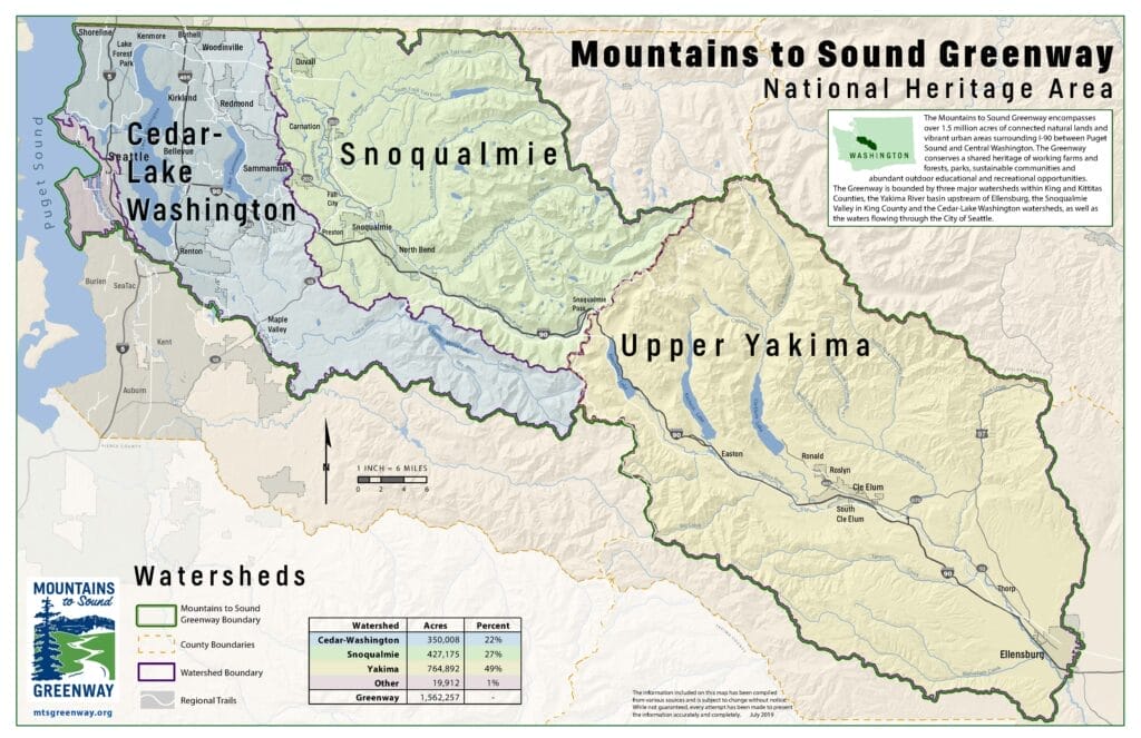
Watersheds
The Greenway is bounded by three major watersheds within King and Kittitas Counties, the Yakima River basin upstream of Ellensburg, the Snoqualmie Valley in King County and the Cedar-Lake Washington watersheds, as well as the waters flowing through the City of Seattle.
Regional Trails
The Mountains to Sound Greenway encompasses a world-class regional trail system. The vision is that a walker or bicyclist could travel, for recreation or as a commuter, on safe, enjoyable, non-motorized trails, connecting Puget Sound urban areas, the Cascade Mountains and Central Washington State. Missing links in this regional system are some of the most difficult to fill, and require ongoing, dedicated effort. This map is meant to encourage ways to complete trail connections, creating a magnificent legacy for all ages and into the future.